
Search results for: sites%2520that%2520offer%2520cheap%2520airline%2520tickets%2520phone%2520number%25201-800-299-7264/https:/seagrant.whoi.edu/wp-content/uploads/2018/06/Greg_Snow-300x297.jpg
Update on River Herring Network
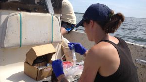
Update on River Herring Network Dec. 2017 — Each spring river herring come from the ocean and swim, or “run” up rivers to spawn in ponds and slow sections of rivers. Each fall, Massachusetts river herring wardens gather together to talk about their favorite fish and discuss ways to preserve it. For centuries, people used…
Read MoreNOAA Live! Webinars
NOAA Live! Webinars • Wednesdays at 4 pm ET • Tuesdays at 3 pm ET – Alaska Series Features • Different NOAA expert and topic with each webinar • Moderated Q&A webinars with the scientists • Geared toward Grades 2-8 • Archive of past webinars with English captions and Spanish subtitles • Why do we…
Read MoreBulletin: Clam Tents: A New Approach to Soft-Shell Clam Culture and Management
Bulletin: Clam Tents: A New Approach to Soft-Shell Clam Culture and Management Soft-shell clams, Mya arenaria, are an enigma to scientists, managers, and shellfish harvesters in southeastern Massachusetts and throughout the bivalve’s range. One year, clams may settle in very dense concentrations, while, the following year, there may be no soft-shell clam recruitment at the…
Read MoreHistoric Shipwreck Management: Meeting of Experts II
Historic Shipwreck Management: Meeting of Experts II Hoagland, P. 51 pp., 1993, $3.00 WHOI-T-93-002
Read MoreUnderstanding the Waquoit Bay Ecosystem
A Q&A with Sarah Foster Sarah Foster is a Boston University graduate student doing her dissertation research in Waquoit Bay (Cape Cod, Massachusetts). A biogeochemist, Sarah investigates the impact hypoxia, or low oxygen, in the water has on crucial functions within Waquoit Bay’s ecosystem. She recently published research she and her co-author, Wally Fulweiler conducted in…
Read MoreWHOI-R-98-003 Gonzalez-Gil, S. Detection and
WHOI-R-98-003 Gonzalez-Gil, S. Detection and
Read MoreBenthic Mariculture and Research Rig Developed for Diver Operation
Benthic Mariculture and Research Rig Developed for Diver Operation Hampson, G.R., D.C. Rhoads, and D.W. Clark Diving for Science…1989, Proceedings of the American Academy of Underwater Sciences, Ninth Annual Scientific Diving Symposium, Woods Hole, MA, pp. 113-117, 1989 WHOI-R-89-017
Read MoreTeacher Workshop November 2003
Teacher Workshop November 2003 “Right Whale Ecology at the Intersection of Science, Technology, and Conservation” Dr. Mark Baumgartner is an Assistant Scientist in the Biology department of Woods Hole Oceanographic Institution. He studies the foraging behavior and ecology of whales, and the formation and location of the patches of plankton that whales feed on. In this…
Read MoreMapping Katama Bay’s Restless Sands
Boaters on Martha’s Vineyard know navigational maps of Katama Bay become obsolete very quickly. Why do the sands at the bottom of the Bay shift so much and so often? Katama Bay has two inlets. Water pours in from Vineyard Sound through Edgartown Channel, and from the Atlantic Ocean through Katama Inlet. The size and…
Read More2017 NCC
Nantucket Coastal Conference June 6, 2017 Nantucket Atheneum Great Hall, Nantucket, Mass. Keynote Coastal Change Rob Thieler, USGS –Woods Hole, Center Director Coastal Erosion Shifting Sands and the Shorelines of Nantucket Andrew Ashton, Woods Hole Oceanographic Institution (WHOI) Sconset Geotube Update Maria Hartnett, Epsilon Associates; Twenty-three Years of Monitoring Sciasconset, MA Mitch Buck, Woods Hole…
Read More