Coastal Impacts
Woods Hole Sea Grant Newsletter
June 2018
From the Director

In this edition of our e-newsletter, we highlight two examples of how Woods Hole Sea Grant can play a role. On the research front, WHOI scientist Jeff Donnelly and co-workers are reconstructing past storm activity on Cape Cod from clues stored in the sediments of coastal salt ponds. The idea here is that we can learn from history as a means to prepare for the future. From our staff, Extension Agents Greg Berman and Shannon Jarbeau surveyed post storm damage in cooperation with county and state agencies. They also provide towns with the information they need to evaluate the threat and what they can do to preserve these important coastal resources.
Thank you for subscribing to our newsletter and please feel free to share it with your friends!
-- Matt Charette
Research: Sediment Cores Hold Clues to Past Hurricanes
June 1 marked the start of the Atlantic hurricane season. After last year’s extremely active and costly hurricane season, many are asking whether ocean warming, sea-level rise, and climate disruption are signaling a new, more intense hurricane regime. Should we in the Northeast do more to prepare for powerful hurricanes?
To know what to expect, we look to the past. But our instrumental archive of hurricanes dates back to just 1851. It shows southeastern New England has not experienced hurricanes of Category 3 intensity or higher. But are storms of that magnitude possible here?
Read moreRead Less

WHOI scientist Jeff Donnelly and co-workers are reconstructing past storm activity on Cape Cod from clues stored in the sediments of Salt Pond in Falmouth, Mass. Photo by Ken Kostel/WHOI.
Dr. Jeff Donnelly, a scientist at the Woods Hole Oceanographic Institution, has been working to extend the record of past hurricanes in the western North Atlantic and Caribbean by looking at sediment cores. Donnelly’s team extracts the cores from isolated basins where sediments accumulate continuously and are vulnerable to hurricane-induced waves and currents. In the Caribbean, he takes cores from so-called “blue holes” – deep depressions in the seafloor where sediment funnels in and settles, becoming trapped and undisturbed by subsequent extreme events.
In the Northeast, Donnelly has been taking cores from Salt Pond in Falmouth, Mass., a brackish coastal pond with a 3-foot high coastal barrier between it and the ocean. During powerful storms, waves wash over the barrier, carrying large amounts of gravel and sand into Salt Pond that are distinct from the otherwise fine-grained sediment that normally settles there. It is these sandy layers that become a marker of the storm that can be seen in the sediment record.
With Woods Hole Sea Grant funding, Donnelly extracted six cores from Salt Pond and used them to reconstruct a 2000-year history of past storms, and, significantly, to infer the intensity of those storms on the Saffir-Simpson Hurricane Wind Scale.
“Hurricanes of greater intensity than have been experienced in recent history are possible here in southeastern New England,” says Donnelly. In fact, “the cores provide the first evidence of strong Category 3 and perhaps even Category 4 hurricanes in this region over the past 2000 years.”

Sand fraction of event bed dating to the 9th century CE (top) and 8th century CE (bottom). The event bed deposited ca. 780 CE is significantly coarser consistent with a heightened wave heights with a catastrophic hurricane. Black bar = 1 mm. Image courtesy J. Donnelly.
To reach this finding, Donnelly looked for unusual deposits of large-grained material -- “event beds” -- amidst the layers of mud in the cores. Donnelly observed 29 hurricane event beds in the Salt Pond cores, and matched a number of them to historic storms of known intensity. Several of the event beds Donnelly studied were significantly coarser than the remainder of the deposits and coarser still than those known storms – data that helped inform the conclusion that strong Cat 3 and 4 storms have occurred in this region in the past.
“By looking at how grains were sorted during those events and using inverse modeling, were able to determine the relative local magnitude of storm waves and sustained wind speeds from the event’s deposits dating back 2000 years,” Donnelly says.
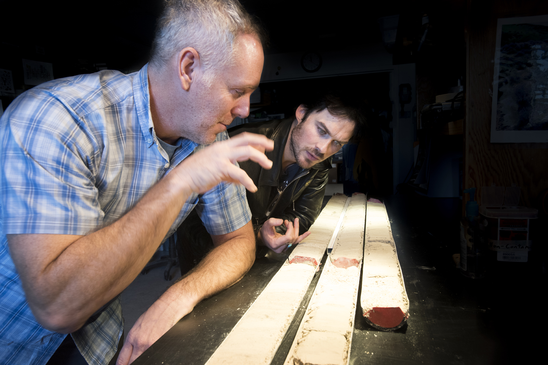
Donnelly and his team have done a lot of outreach to educate others about their research methods and findings, including participating in documentaries for the PBS series NOVA and for Showtime’s Years of Living Dangerously.

Donnelly with Ian Somerhalder during production of the documentary Years of Living Dangerously. Photo by Tom Kleindinst/WHOI.
“Using sediments hidden beneath our coastal ponds, Donnelly and his team are not only painting a picture of the past, but also helping improve understanding of what the future may hold in a changing climate,” says Sea Grant Director Matt Charette. “This is information that is critical for everyone from local residents to emergency planners and municipalities to insurance companies.”
Getting scientific information into the hands of end users so they can make informed decisions a central part of Sea Grant’s mission. Donnelly agrees, adding, “What makes Sea Grant unique is that it facilitates the transfer of scientific results so that people can use it. And it provides a great opportunity to support fundamental science.”
Outreach: Reporting from the Heart of the Storm
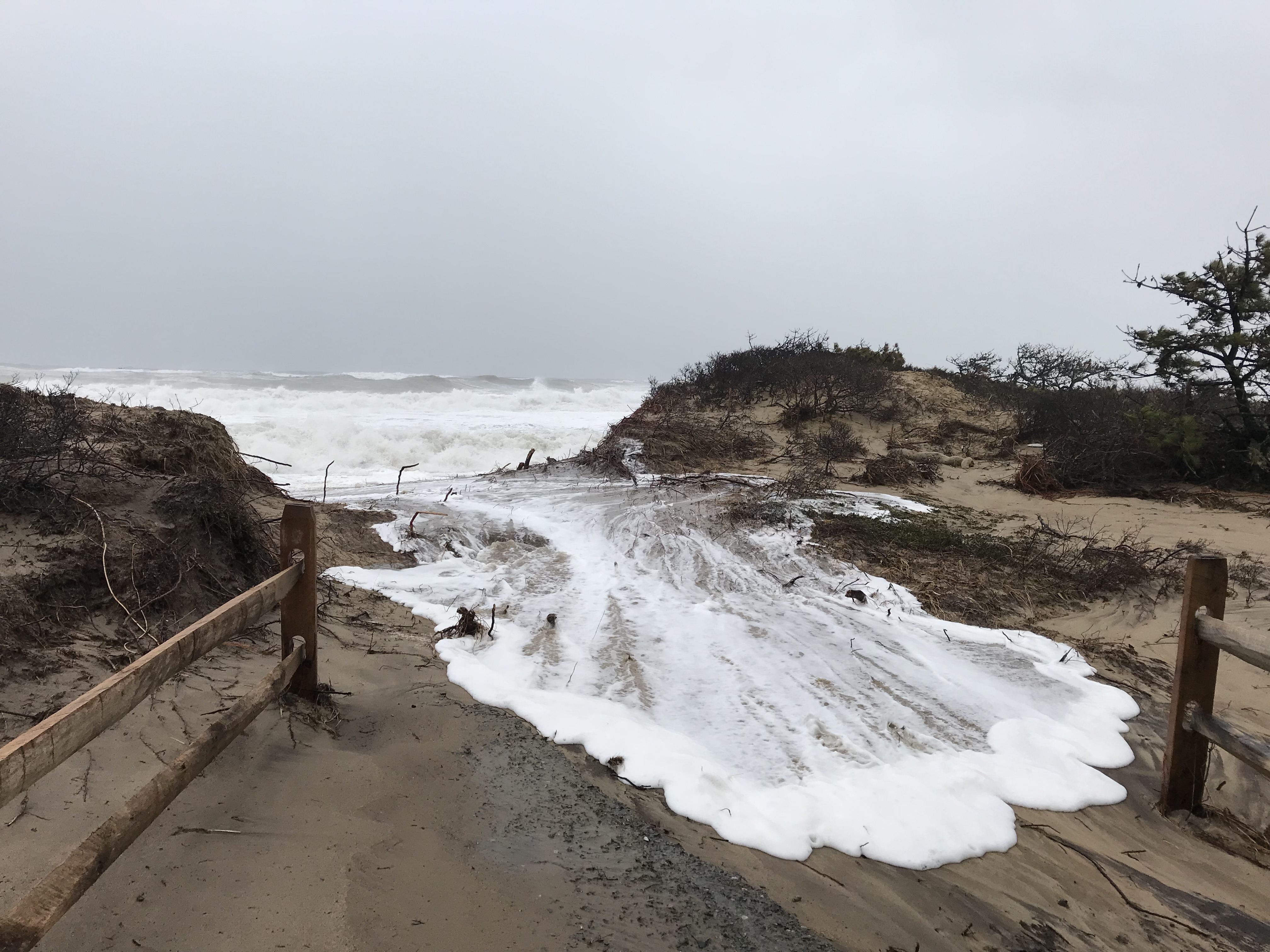
The winter storms of 2018 are experiences most of New Englanders would like to forget. However, the pounding the region took through the month of March left an indelible mark on many north and east facing towns and beaches, destroying homes, buildings, and other structures, and eroding swaths of shoreline.
This week the White House and the Federal Emergency Management Agency (FEMA) responded to Gov. Charlie Baker’s request for federal disaster assistance for Massachusetts counties impacted by the severe storm on March 2-3. Six of the hardest hit counties will receive assistance: Barnstable, Bristol, Essex, Nantucket, Norfolk and Plymouth.
Read moreRead Less
The Governor’s request for assistance was backed up by data collected by dozens of experts in coastal towns across the state. While most people hunker down in Nor’easters and pray the power stays on, Greg Berman and Shannon Jarbeau, extension agents with Woods Hole Sea Grant and Barnstable County’s Cape Cod Cooperative Extension, are often out in the thick of it, sometimes driving through white-out conditions to track the storm’s local impact.
“We’re a different breed,” says Berman, a coastal processes specialist whose expertise is often tapped to inform town management plans and decisions. “We like to be out there. That’s when extreme erosion and flooding are happening.”
Berman and Jarbeau are part of the Massachusetts Rapid Response Coastal Storm Damage Assessment Team coordinated by the Massachusetts Office of Coastal Zone Management (CZM). The team comprises some 61 trained personnel from state and federal agencies and local governments who go out during and after moderate to major storms to conduct visual assessments of storms’ impacts on the coast. Wearing ski goggles to protect their eyes from sand and pelting sleet, and big heavy boots for trekking in rough conditions, Berman and Jarbeau, like the other team members, take photographs and record notes, reporting back to the CZM in real time using the “Storm Reporter” tool in an app called “MyCoast.”
CZM’s Rebecca Haney coordinates the Storm Team and activates them based on forecasts from the National Weather Service. Berman and Jarbeau, she says, are “incredibly helpful” and essential to coverage on the Cape.
“Our Storm Team collects damage level information in coastal communities across the Commonwealth,” Haney says. “They’re reporting on road conditions, whether they’re passable or flooded or blocked due to fallen trees. They’re photographing damage where they find it – whether it’s boats and floats in marinas and harbors, or stairs, decks, porches of houses or worse – damage to windows, walls, and foundations. They look at coastal structures -– revetments, sea walls, beach and dune barriers -- and upload their reports to our system.”
Because Berman and Jarbeau are responsible for reporting on several Cape towns, it means a lot of driving. “It can be nerve wracking and we’re pretty exhausted by the end of day,” says Jarbeau, a floodplain coordinator, but the information they collect is critical to decision makers in the Massachusetts Emergency Management Agency’s State Emergency Operations Center. MEMA sends the Storm Team data about how severe and widespread the damage is to the Governor and others, along with data provided by other state and local officials so that rapid decisions can be made about where to apply the state’s resources, as well as potentially for a federal disaster assistance request. Additionally, the reports are shared with the National Weather Service in Taunton to help calibrate and refine its models to improve its prediction capabilities for future storms.
In March 2018, New England experienced four nor’easters. The first one, March 2-3, did the most damage. The wind and waves from that storm damaged many shorefront homes, causing a complete loss in a handful of cases on Cape Cod. This includes the iconic Liam's
Clam Shack at Orleans Nauset Beach, a historic home at Ballston Beach in Truro, and several homes on barrier beaches in Sandwich. The highest winds gusts in the state were reported by three Cape towns: Barnstable (93 mph), East Falmouth (92 mph), Wellfleet (91 mph). Flood waters were very slow to recede between high-tide cycles, and there was wide-spread erosion. Town Neck in Sandwich lost nearly 40 feet of a dune protecting its parking lot, while Nauset Beach in Orleans, saw 60 feet of erosion.
The storm surge from the March 2 storm had not entirely subsided by the time the next nor’easter arrived on March 8, which was followed by another storm on March 13 and another on March 22. Gov. Baker’s request for disaster assistance following the March 13 storm is still pending.
Nor’easters like the ones experienced this winter test the durability of shoreline stabilization projects and help inform future projects. Being part of the Storm Team allows Berman and Jarbeau to see which projects hold up or fail under tough conditions, adding to their expertise and contributing to their value as resources for municipalities and others.
The 2018 storms may be remembered a few years from now as part of a particularly “bad” winter or, with extreme weather events increasing under new climate regimes, perhaps they will be seen as the “new normal.” In either case, Berman and Jarbeau will continue their valuable work with Woods Hole Sea Grant and the Cape Cod Cooperative Extension to improve shoreline resilience.The winter storms of 2018 are experiences most of New Englanders would like to forget. However, the pounding the region took through the month of March left an indelible mark on many north and east facing towns and beaches, destroying homes, buildings, and other structures, and eroding swaths of shoreline.
This week the White House and the Federal Emergency Management Agency (FEMA) responded to Gov. Charlie Baker’s request for federal disaster assistance for Massachusetts counties impacted by the severe storm on March 2-3. Six of the hardest hit counties will receive assistance: Barnstable, Bristol, Essex, Nantucket, Norfolk and Plymouth.
The Governor’s request for assistance was backed up by data collected by dozens of experts in coastal towns across the state. While most people hunker down in Nor’easters and pray the power stays on, Greg Berman and Shannon Jarbeau, extension agents with Woods Hole Sea Grant and Barnstable County’s Cape Cod Cooperative Extension, are often out in the thick of it, sometimes driving through white-out conditions to track the storm’s local impact.
“We’re a different breed,” says Berman, a coastal processes specialist whose expertise is often tapped to inform town management plans and decisions. “We like to be out there. That’s when extreme erosion and flooding are happening.”
Berman and Jarbeau are part of the Massachusetts Rapid Response Coastal Storm Damage Assessment Team coordinated by the Massachusetts Office of Coastal Zone Management (CZM). The team comprises some 61 trained personnel from state and federal agencies and local governments who go out during and after moderate to major storms to conduct visual assessments of storms’ impacts on the coast. Wearing ski goggles to protect their eyes from sand and pelting sleet, and big heavy boots for trekking in rough conditions, Berman and Jarbeau, like the other team members, take photographs and record notes, reporting back to the CZM in real time using the “Storm Reporter” tool in an app called “MyCoast.”
CZM’s Rebecca Haney coordinates the Storm Team and activates them based on forecasts from the National Weather Service. Berman and Jarbeau, she says, are “incredibly helpful” and essential to coverage on the Cape.
“Our Storm Team collects damage level information in coastal communities across the Commonwealth,” Haney says. “They’re reporting on road conditions, whether they’re passable or flooded or blocked due to fallen trees. They’re photographing damage where they find it – whether it’s boats and floats in marinas and harbors, or stairs, decks, porches of houses or worse – damage to windows, walls, and foundations. They look at coastal structures -– revetments, sea walls, beach and dune barriers -- and upload their reports to our system.”
Because Berman and Jarbeau are responsible for reporting on several Cape towns, it means a lot of driving. “It can be nerve wracking and we’re pretty exhausted by the end of day,” says Jarbeau, a floodplain coordinator, but the information they collect is critical to decision makers in the Massachusetts Emergency Management Agency’s State Emergency Operations Center. MEMA sends the Storm Team data about how severe and widespread the damage is to the Governor and others, along with data provided by other state and local officials so that rapid decisions can be made about where to apply the state’s resources, as well as potentially for a federal disaster assistance request. Additionally, the reports are shared with the National Weather Service in Taunton to help calibrate and refine its models to improve its prediction capabilities for future storms.
In March 2018, New England experienced four nor’easters. The first one, March 2-3, did the most damage. The wind and waves from that storm damaged many shorefront homes, causing a complete loss in a handful of cases on Cape Cod. This includes the iconic Liam's
Clam Shack at Orleans Nauset Beach, a historic home at Ballston Beach in Truro, and several homes on barrier beaches in Sandwich. The highest winds gusts in the state were reported by three Cape towns: Barnstable (93 mph), East Falmouth (92 mph), Wellfleet (91 mph). Flood waters were very slow to recede between high-tide cycles, and there was wide-spread erosion. Town Neck in Sandwich lost nearly 40 feet of a dune protecting its parking lot, while Nauset Beach in Orleans, saw 60 feet of erosion.
The storm surge from the March 2 storm had not entirely subsided by the time the next nor’easter arrived on March 8, which was followed by another storm on March 13 and another on March 22. Gov. Baker’s request for disaster assistance following the March 13 storm is still pending.
Nor’easters like the ones experienced this winter test the durability of shoreline stabilization projects and help inform future projects. Being part of the Storm Team allows Berman and Jarbeau to see which projects hold up or fail under tough conditions, adding to their expertise and contributing to their value as resources for municipalities and others.
The 2018 storms may be remembered a few years from now as part of a particularly “bad” winter or, with extreme weather events increasing under new climate regimes, perhaps they will be seen as the “new normal.” In either case, Berman and Jarbeau will continue their valuable work with Woods Hole Sea Grant and the Cape Cod Cooperative Extension to improve shoreline resilience.
Policy: A Knauss Fellow's Experience
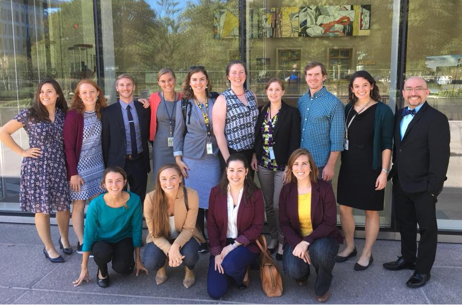
A year in D.C. as a Sea Grant Knauss Fellow can be a life-changing experience.
The Sea Grant Knauss Fellowship is a prestigious educational and professional experience for graduate students with an interest in ocean, coastal and Great Lakes resources and in the national policy decisions affecting those resources. The Fellowship, named after one of Sea Grant's founders, former NOAA Administrator, John A. Knauss, matches highly qualified graduate students with "hosts" in the legislative and executive branch of government located in the Washington, D.C. area, for a one year paid fellowship.
Read moreRead Less
A Woods Hole Sea Grant nominee and graduate of the MIT-WHOI Joint Program, Dr. Ellie Bors was placed as a 2017 Knauss Fellow with the NOAA Office of International Affairs (OIA), a staff office that provides strategic direction, advice, and coordination for NOAA’s international engagement and ensures that engagement is consistent with U.S. foreign policy.
Bors’s work at OIA spanned diverse topics. She served as the main point of contact for NOAA’s scientific engagement with Cuba, briefed NOAA’s leadership for high-level international conferences, and advised on invasive marine species policy in the Arctic, which drew on her scientific background studying the genetics of invading species. In her capacity as a Fellow, Bors participated in the working group of the Protection of the Arctic Marine Environment (PAME) of the Arctic Council. The Arctic Council is the leading intergovernmental forum promoting cooperation, coordination and interaction among the eight countries with jurisdiction in the Arctic, Arctic indigenous communities and other Arctic inhabitants on common Arctic issues, in particular on issues of sustainable development and environmental protection. The PAME working group addresses policy and non-emergency pollution prevention and control measures related to the protection of the Arctic marine environment from both land and sea-based activities.
“It was an incredible year,” says Bors. As a Fellow, Bors immersed herself in the complex issues NOAA is involved in and developed an aptitude for strategic political thinking, speaking to diverse people from many different backgrounds, writing in a policy context, and sometimes navigating difficult diplomatic interactions.
In the course of her work, Bors says she developed a great network of colleagues in the domestic and international policy realm, and discovered a lot about what’s important to her in her career. She also participated in a number of enriching professional development opportunities, which are an integral part of the Knauss Fellowhsip. They ranged from giving a presentation on invasive species and conservation at an academic meeting in Colombia to attending networking meetings in DC, to traveling to Finland for an Arctic Council Working Group meeting, to attending a two-day workshop in London and giving an invited talk at the University of Exeter.
But, says Bors, one of the most memorable professional development activities of her fellowship was participation in Bering Sea Days, a week-long event held on St. Paul Island in the Pribilof Islands, 300 miles west of the Alaska mainland. The Pribilof Islands are a cluster of islands that sit in the middle of the Bering Sea, not far from the break of the continental shelf. Each year, scientists and educators from multiple government agencies travel to St. Paul and interact with the 60 or so pre-K – 12 students on St. Paul to provide novel learning experiences and career options in the sciences and more.

Ellie Bors, far right, led St. Paul's students in a mock-Arctic Council meeting during Bering Sea Days.
Bors spent her week there teaching the middle and high school students on St. Paul Island about how governments work together to develop strategy and action plans to tackle environmental problems. She developed a lesson plan to have the students simulate an Arctic Council meeting, with groups of students representing the positions of various member states in the Council. Bors wrote about the event in an article for NOAA.gov.
“It was an enriching experience,” says Bors. “I was able to glimpse life in the sub-Arctic in small indigenous communities. And I was able to apply knowledge from my fellowship year, meet extraordinary educators and scientists, and spend time on the stunning island of St. Paul. I am extremely thankful for my Knauss year.”
Bors is currently a Postdoctoral Scholar in the Marine Mammal Institute at Oregon State University's Hatfield Marine Science Center. She works with Dr. Scott Baker to develop molecular methods to determine the age of endangered Cook Inlet beluga whales. She was also named one of 16 Fulbright Arctic Initiative Scholars for 2018-2019 and is studying distributional shifts in Arctic fish species.
Education: When Teachers Become the Students
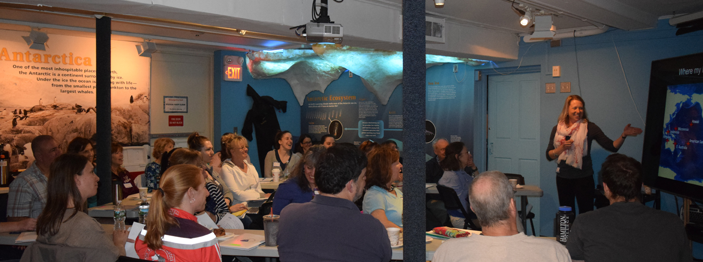
A group of twenty-nine middle and high school teachers filled the Woods Hole Oceanographic Institution (WHOI) Ocean Science Discovery Center to capacity on May 4, 2018, for a behind-the-scenes look at the science of and the methods used in studying corals, their symbionts, and climate change. The “Topics in Oceanography” workshop, sponsored by Woods Hole Sea Grant, the WHOI Information Office and WHOI Academic Programs office, brought together WHOI scientists working at the leading edge of coral research and teachers from school districts as far away as southern New Hampshire and as close as Falmouth for a day of interaction and learning.
Read moreRead Less
“Our workshops let teachers learn directly from the scientists who devote their lives to this research,” said Woods Hole Sea Grant Educator Grace Simpkins. “Teachers value this rare opportunity and tell us it re-energizes them and their students in the classroom.”
Dr. Konrad Hughen, a senior scientist in WHOI’s Marine Chemistry and Geochemistry (MC&G) department, discussed his work studying corals as a record of climate history and
climate change. Hughen brought the teachers on a virtual dive using an incredibly vivid 3-D video of his work taking core samples at coral reefs, giving the teachers a virtual experience of field research. They also heard from Dr. Amy Apprill, an associate scientist in WHOI’s MC&G department, who gave a detailed overview of corals and their symbionts while describing how vital this complex dynamic is to the whole ecosystem. Apprill discussed coral bleaching and how increasingly rare a healthy, undisturbed coral ecosystem is becoming.
“I love hearing from scientists who are currently learning new information from their research,” commented one teacher – a sentiment echoed by many others.
After lunch and some time to experience the WHOI Discovery Center, the teachers explored corals and core drilling in Dr. Hughen’s lab and then toured the WHOI Seafloor Samples Laboratory. They were amazed at the volume of cores stored in the samples facility and impressed by the vast quantities of potential data on hand for future research.
Offered twice a year, the workshops focus on current marine topics and the applicable science education standards. Climate change and human impacts are part of the 2016 MA science, technology, and engineering standards, and several attendees said they plan to integrate what they learned at the workshop into their curriculum to address those standards. “We are introducing more and more climate topics,” said one teacher. “The coral symbionts are a great way to show the impact.” The teachers were also given background material as well as data and sample lesson plans they can incorporate in their classrooms once they return home. “The WHOI/Sea Grant workshops are excellent and a great resource for educators,” an attendee commented.
Teachers attending the “Topics in Oceanography” workshops earn professional development points. If you’d like to be notified about future workshops, contact Grace Simpkins, gsimpkins@whoi.edu.
Recent Events
Martha’s Vineyard Coastal Conference
News from the conference
» The Coast with the Most
Martha’s Vineyard Times
» Scientists Urge Action Plan on Climate Change
Vineyard Gazette
Marine Shrink Wrap Program
Want to subscribe to Coastal Impacts?
Please contact seagrant@whoi.edu
Woods Hole Sea Grant
Woods Hole Oceanographic Institution
193 Oyster Pond Rd.
Woods Hole, MA 02543
