
Citizens and Scientists Monitoring Change at Town Neck Beach
A citizen science effort in Sandwich is getting an extra boost from WHOI researchers and a statewide portal for collecting photos of coastal flooding, coastal storm impacts, and shoreline adaptation.

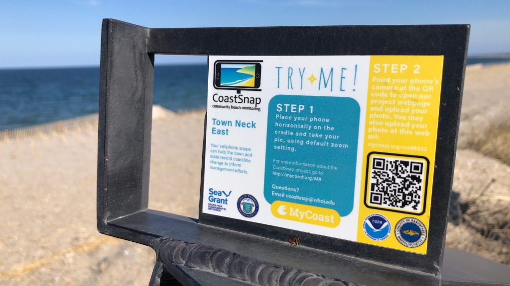
Installed by WHOI Sea Grant in partnership with the Town of Sandwich in 2020, the CoastSnap cradles at Town Neck Beach have been a simple tool utilized by the community to build a database of shoreline observations. Visitors slide their cell phone into the cradle and snap a photo capturing conditions at the beach at that moment and share it to a database. Over time, these crowdsourced images build a record of short- and long-term beach erosion and recovery at Town Neck Beach and can help to inform management decisions.
A recent collaboration with the MA Office of Coastal Management has given the WHOI Sea Grant team access to MyCoast, an application the state uses to record storm damage, king tides, and flooding. MyCoast syncs automatically with NOAA tide gauges and other weather databases, attaching the data to the image the moment it is uploaded to MyCoast. The software developers have added a “CoastSnap” tab into the state’s MyCoast app, connecting the citizen science project to powerful databases and image management software, instantly expanding its usefulness and scientific value.
Now, a team of researchers at WHOI are joining the effort and hope to be able to extract more information from the images about the forces impacting Town Neck Beach and the changes that are happening. “Using computer coding, the CoastSnap images will be transformed into a birds eye view of the beach, mapping the beach with real-world coordinates,” says Rilee Thomas, a PhD student in the MIT-WHOI Joint Program in Oceanography, working with glaciologist and climate scientist Dr. Sarah Das. “The imagery allows us to plot the position of the shoreline and see how it accretes or erodes over time, as well as how the dunes are moving and how the Town’s sand renourishment efforts affect the beach.”
To be most effective, the researchers need several photos per week from the Town Neck CoastSnap station. Over the past three years, there have been a couple of “super” users who contribute images from the CoastSnap station at Town Neck Beach on a regular basis, but WHOI Sea Grant hopes to find more. As CoastSnap participation grows, not only will scientists have great ability to measure change, but the citizen scientists will be more engaged with the environmental changes happening around them and the management tactics being taken to mitigate it, such as renourishment.
You can see a timelapse of images from Town Neck Beach at (https://www.youtube.com/watch?v=tQ7XRapMZNM).