
Becoming a beach scientist is a snap. Share your photos from iconic beaches to help us better understand and manage our dynamic coast.
Mariner's Memorial Way
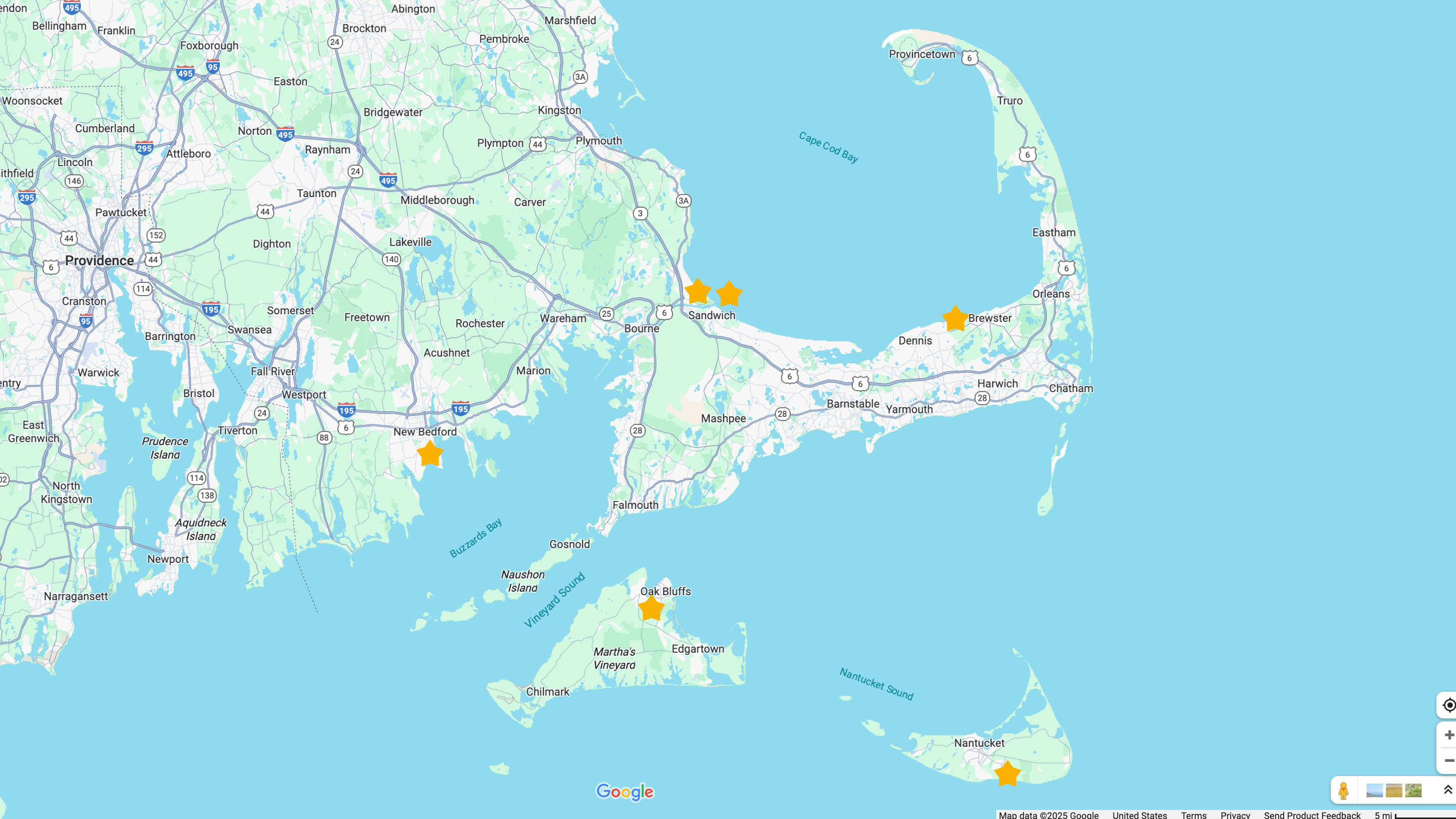
New Bedford, MA
State Beach
Oak Bluffs, Martha's Vineyard, MA
Linnell Landing
Brewster, MA
Town Neck Beach (East and West)
Sandwich, MA
South Cape Beach
Mashpee, MA
End of Hummock Pond Rd.
Nantucket, MA

Your snaps will help to improve the way local communities and governments manage our valuable beach environments.
1. Snap.
Place smartphone on the camera cradle and take a photo.
2. Share.
Point your phone's camera at the QR code on the CoastSnap sign to upload your photo using MyCoast app. You may also email your photo to coastsnap@whoi.edu.
Contact
Sandwich, MA
Visit MyCoast.org/MA to see timelapse slideshows at each location.
Town Neck Beach, East & West
East- and west-facing CoastSnap cradles are set up at Town Neck Beach in Sandwich. Town Neck Beach has been deprived of material from longshore sediment transport by nearby jetties for over 100 years. This lack of sand input, combined with rising sea levels, has led to the relatively rapid erosion of this section of shoreline. Shoreline protection for homes needs constant vigilance and without active nourishment the barrier beach would not be able to sustain its current location. By documenting the mobilization of the placed sediment, it is possible to show that not all sand eroded from the artificial dune is “lost.” Instead, it is redistributed along the beach and intertidal zone, creating a system more resilient to future coastal storms. Visit MyCoast.org/MA to see timelapse of photos.


Oak Bluffs, MA
State Beach Martha's Vineyard
"Little Bridge" inlet by Sengekontacket Pond
State Beach is a relatively narrow barrier beach system that has been highly managed for many years. Due to the thin nature of the barrier islands it is not feasible to allow migration of these landforms while allowing road access to this very heavily utilized recreational beach. This CoastSnap was located to allow outreach on the dynamic nature of sediment in the inlet. After the inlet becomes clogged with sand, it is dredged in order to preserved the tidal flushing of Sengekontacket Pond and that material is then distributed along the barrier beach in order to maintain the landform. Visit MyCoast.org/MA to see timelapse of photos.


Nantucket, MA
End of Hummock Pond Rd.
Nantucket has some of the highest erosion rates in Massachusetts. Nantucket’s Coastal Resilience Plan (CRP) has 40 island-wide recommendations to reduce risks of flooding and erosion along our coastline while keeping people safe, promoting healthy and vibrant communities, and honoring the cherished built and natural heritage of Nantucket. If these recommendations are not implemented by 2070, the cumulative expected losses and damages could total $3.4 billion, which far exceeds the cost to implement the CRP. Visit MyCoast.org/MA to see timelapse of photos.


New Bedford, MA
Mariner's Memorial Way
Many people think New Bedford is safe from coastal storms due to its hurricane barrier, but the coastline is still changing every day and with every storm. CoastSnap at Mariner’s Memorial Way was constructed in partnership with students from Greater New Bedford Regional Vocational Technical High School to track change at one of the most historic and vulnerable sites around the city. Visit MyCoast.org/MA to see timelapse of photos.


Brewster, MA
Linnell Landing
Brewster is known for its wide flats and sandy beaches. CoastSnap at Linnell Landing is helping to keep track of how these beautiful coastal features change with storms, tides, and sea level rise. Visit MyCoast.org/MA to see timelapse of photos.


Mashpee, MA
South Cape Beach
With its soft sand and warm water, South Cape Beach is a popular summer destination. But it's more than just a great place to relax; year round, South Cape also serves as a barrier for marshes, ponds, and habitats. Working with our friends at Waquoit Bay National Estuarine Research Reserve, we installed a CoastSnap post to make monitoring and protecting this shoreline as easy as “snap and scan!” Whether you're there enjoying the summer sunshine or braving a winter walk along the shore, you can help us track the coastal change by sharing your cell phone pics. Visit MyCoast.org/MA to see timelapse of photos.


With your mobile device and our CoastSnap photo cradles, you can capture a valuable record of the beach state, and share it with the hashtags on Facebook and InstaGram or email. Using your snaps, we are building a community database that provides new insights on beach response to changing weather and wave conditions, and extreme storms. Over time, your CoastSnaps will record erosion and recovery cycles, and any long-term changes, helping us understand why some beaches are more dynamic or resilient than others.
CoastSnap was created by researchers at the University of New South Wales in Australia and can now be found in more than 20 countries around the world. For more information on the global CoastSnap effort, see www.facebook.com/coastsnap/.
![]()
![]()
![]()