
Search results for: Open%20%20Sun%20Country%20Airlines%201800-299-7264%20Customer%20Service%20Phone%20Number
An Ethogram of Body Patterning Behavior in the Biomedically and Commercially Valuable Squid Loligo pealei off Cape Cod, Massachusetts
An Ethogram of Body Patterning Behavior in the Biomedically and Commercially Valuable Squid Loligo pealei off Cape Cod, Massachusetts Hanlon, R.T., M.R. Maxwell, N. Shashar, E.R. Loew, and K.-L. Boyle Biol. Bull., Vol. 197, pp. 49-62, 1999 WHOI-R-99-005
Read MoreA Simple Technique for Fine-scale, Vertical Sectioning of Fresh Sediment Cores
A Simple Technique for Fine-scale, Vertical Sectioning of Fresh Sediment Cores Fuller, C.M. and C.A. Butman Journal of Sedimentary Petrology, Vol. 58, No. 4, pp. 763-768, 1988 WHOI-R-88-008
Read MoreFrom Bike Shop to Bay: An intern’s journey into aquaculture
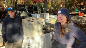
When Aydan Craveiro’s high school shop teacher sent an email about a job opportunity, he couldn’t have imagined where it would lead. The position — a shellfish aquaculture internship on Cape Cod — offered everything he was looking for: outdoor work, housing, and a chance to escape the basement of the bike shop where he’d…
Read MorePost 5: Winter launch
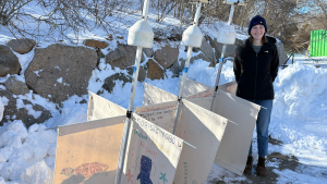
We released our second set of drifters into Cape Cod Bay on Tuesday (2/10/2026). Thank you to the crew of the RV Tioga for deploying the drifters for us! But first, a quick re-cap! Two drifters from the fall deployment escaped Cape Cod Bay – Maddie and Athvika. The Athvika drifter stopped transmitting pings in…
Read MoreEffects of Historic Tidal Restrictions on Salt Marsh Sediment Chemistry
Effects of Historic Tidal Restrictions on Salt Marsh Sediment Chemistry Portnoy, J.W. and A.E. Giblin Biogeochemistry, Vol. 36, pp. 275-303, 1997 WHOI-R-97-002
Read MoreTidal Velocity Asymmetries and Bedload Transport in Shallow Embayments
Tidal Velocity Asymmetries and Bedload Transport in Shallow Embayments Fry, V. and D.G. Aubrey Estuarine, Coastal and Shelf Science, Vol. 30, pp. 453-473, 1990 WHOI-R-90-008 Tidal circulation can cause a net transport of sediment when the tidal velocity is asymmetric about a zero mean (flood or ebb dominant) and the sediment transport rate is related…
Read MoreQ&A with Knauss Fellow Jori Barley

A graduate of UMass Amherst, Jori Barley is a 2024 Knauss Fellow in the NOAA Center for Satellite Applications and Research (STAR). One of NOAA Sea Grant’s most high-profile fellowship, the John A. Knauss Fellowship provides a one-year, paid experience for highly-qualified early career professionals to work on issues related to coastal, marine and Great…
Read MoreShell Day 2019
Shell Day 2019 – Northeast Coastal Acidification Network (NECAN) 2021 Update Woods Hole Sea Grant Research Coordinator Jennie Rheuban presented Shell Day findings during the 2020-2021 webinar series held by NECAN, the Northeast Coastal Acidification Network. First Coastal Acidification Monitoring Blitz in the Northeast Held August 22, 2019, Shell Day’s aim was to engage water…
Read MoreMultiple Genetic Stocks of Longfin Squid Loligo pealeii in the NW Atlantic: Stocks Segregate Inshore in Summer, but Aggregate Offshore in Winter
Multiple Genetic Stocks of Longfin Squid Loligo pealeii in the NW Atlantic: Stocks Segregate Inshore in Summer, but Aggregate Offshore in Winter Buresch, K.C., G. Gerlach, and R.T. Hanlon Marine Ecology Progress Series, Vol. 310, pp. 263-270, 2006 WHOI-R-06-002
Read MoreWHOI-Q-05-003 Portfolio-Estuarine and Coas
WHOI-Q-05-003 Portfolio-Estuarine and Coas
Read More