
Ping! – Using sound to map Alaska’s seafloor
Jessica Murphy and LTjg Michelle Levano, NOAA’s Office of Coast Survey in Seattle, WA
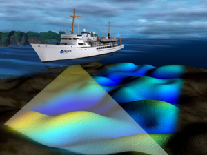
Like marine mammals using sound to “see” their underwater environment, scientists also use sound to determine what the seafloor looks like! Mapping the seafloor provides information for many purposes, including safe navigation of fishing vessels and helping pinpoint where marine animals call home. Join us as we discuss the tools of the trade for mapping the seafloor and the many ways that data is used by scientists for everything from charting the ocean to understanding habitat.
Resources to access at home:
» NOAA’s Office of Coast Survey Educational Activities: Learn more about the seafloor and nautical charting through posters, interactive activities (check out the digital terrain activity!), and hands-on activities you can do at home.
» Alaska Surveys Storymap
» Finding Nautical Charts
» Travel the Seas Video
» Plumbing the Deep: Using Sound Waves to See