NOAA Live! Webinars
March 2020 - April 2022
Features
• Different NOAA expert and topic with each webinar
• Moderated Q&A webinars with the scientists
• Geared toward Grades 2-8
• Archive of past webinars with English captions and Spanish subtitles
• Why do we make an Indigenous Land Acknowledgment?
• FREE NOAA Live! iron-on patch. E-mail gsimpkins@whoi.edu (Grace)
• Lesson activities based on NOAA Live!
Sponsors
• National Oceanic and Atmospheric Administration
• National Sea Grant College Program
• NOAA Office of Education
• Woods Hole Sea Grant
• Woods Hole Oceanographic Institution
Find out about other Woods Hole Sea Grant programs on our social media channels!
Upcoming webinars
We do not currently have any upcoming webinars scheduled.
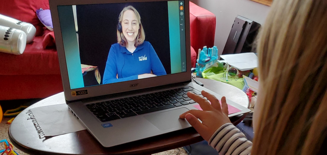
About NOAA Live! webinars
NOAA Live! Webinars were created in response to COVID-19-related school closures. Conducted from March 2020 to present, the webinars are the result of a partnership between NOAA’s Regional Collaboration Network, Woods Hole Sea Grant, and the Woods Hole Oceanographic Institution. These webinars provided students access to scientists, real-life examples of possible career paths, and the opportunity to have fun interacting with others outside their home in a safe way.
Archive
You can search the archive using a keyword or topic filters to the left. NOTE: The NGSS and MA STE standards search function is currently under construction.
Refine by:
Topic
State
NOAA Line Offices
NGSS Topics
MA STE Standards
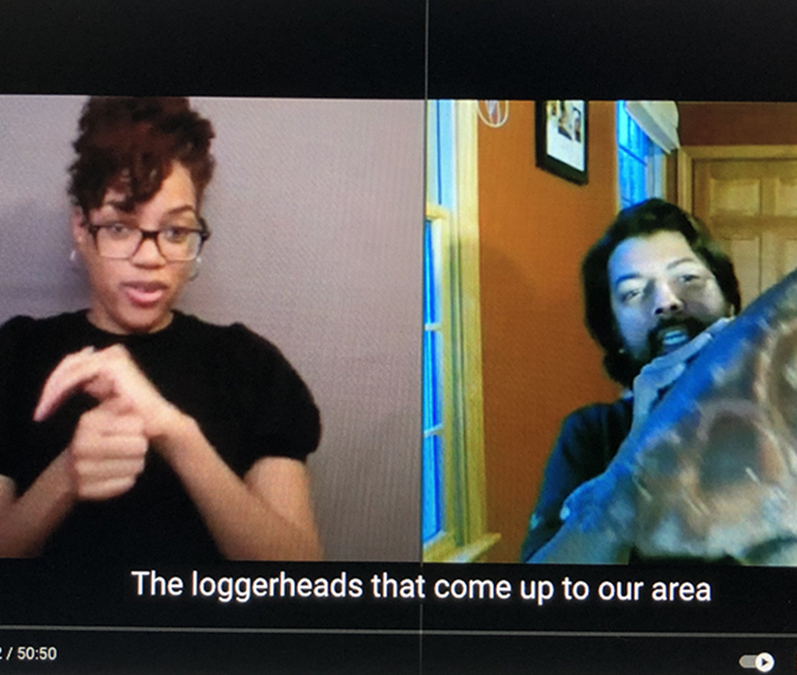
ASL
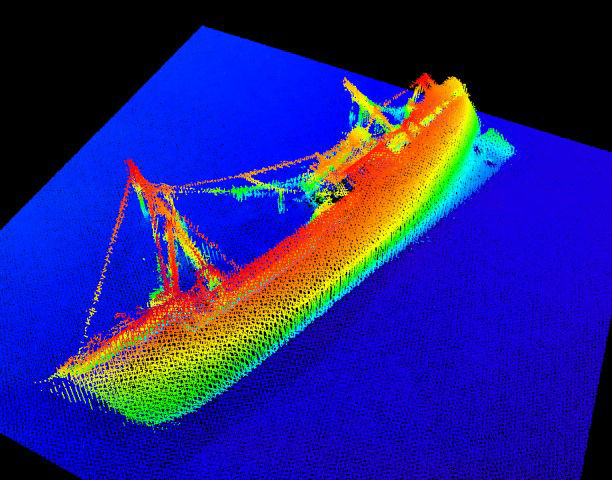
Exploring the Ocean Seafloor: Underwater Volcanoes and their Habitats
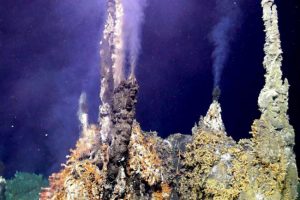
Colleen Hoffman, Cooperative Institute for Climate, Ocean, and Ecosystem Studies and NOAA Pacific Marine Environmental Lab in Seattle, WA
Come learn about the explosive world of underwater volcanoes! Alien looking organisms, robots and submarines, and eruptions are all part of the fun in studying these systems 10,000-13,000 feet below sea level. Narrated by a marine geochemist, we explore an underwater volcano habitat and how we collect samples from the deep.
Resources to access at home:
» Videos used in the talk: Volcanic eruptions on the seafloor, Life at a Hydrothermal Vent, and What it is like to go down in HOV Alvin
Videos:
» Demo for Oreo plate tectonics
» Last 40 years of hydrothermal vent explorations (video showing all the different types of systems)
» C-DEBI deep-sea lesson plans
» NOAA Ocean Today Every Full Moon: Deep Sea Dive Collection
» NOAA Ocean Explorer: Hunting for Alien Life at the Bottom of the Arctic Ocean
» NOAA Ocean Explorer: Hydrothermal Vents: 2016 Deepwater Exploration of the Marianas
» NOAA Ocean Explorer: Education Therme: Vents and Volcanoes lesson plans
» HACON – Hot Vents in an Ice-Covered Ocean
Books:
» Exploring the Deep, Dark Sea by Gail Gibbons.
» Alien Deep: Revealing the Mysterious Living World at the Bottom of the Ocean (National Geographic Kids) by Bradley Hague.
» Discovering the Deep by Jeffrey A. Karson, Deborah S. Kelley, Daniel J. Fornari, Michael R, Perfit, and Timothy M. Shank.
![]()
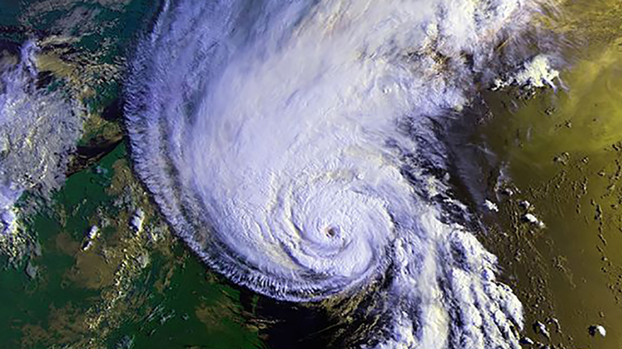
Not Your Friendly Neighborhood Wave: Staying Safe from Tsunamis in Alaska
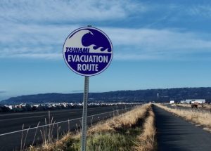
Dr. Summer Ohlendorf, NOAA’s National Weather Service Tsunami Warning Center in Palmer, AK
Earthquakes, volcanoes, landslides, oh my! What’s one thing these hazards have in common? They’re all capable of moving a large amount of water very quickly, creating a special set of waves called a tsunami. While the most well known tsunami up here is the 1964 Great Alaska Earthquake and Tsunami, tsunamis can come in many sizes and remain an ongoing threat to coastal Alaskans. On the heels of World Tsunami Awareness Day (Nov. 5), we’ll share some of the things that make tsunamis different from regular waves, how scientists monitor and warn for tsunamis, and how you can keep yourselves and your families safe.
Resources to access at home:
» NOAA Educational Tsunami Resources
» Alaska tsunami evacuation maps and more!
» Interactive tsunami inundation/flooding maps
» Alaska geohazard educational resources – Earthscope Alaska Native Geoscience Learning Experience (ANGLE)
» NOAA Mitigates the Impact of Killer Waves – Storymap
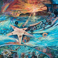
Born is the Coral Polyp, A Creation Story from Hawai’i
Malia K. Evans, NOAA’s Papahānaumokuākea Marine National Monument in Wai’anae, Hawai’i
Emerging from the deep darkness was the tiny coral polyp, the first life form born in the Kumulipo, a Hawaiian creation story. The 2,100 line chant establishes and reaffirms the family relationships Native Hawaiians maintain to the natural environment, to each other and to our oldest ancestor the coral polyp. This presentation and hands-on activity will explore this sacred origin story as we deepen our understanding of Native Hawaiian oral traditions, basic coral polyp anatomy and the practice of mālama ‘āina, to care for and respect the natural world around us. ACTIVITY DURING THE WEBINAR: We made our own coral polyp art during the webinar. Click here for instructions and a full materials list! Submit your artwork here for us to post on our website!
Resources to access at home:
» Papahānaumokuākea Marine National Monument main page: This site has a map of the Monument, links to education resources, virtual visits, voices of Papahānaumokuākea, and more.
» Native Hawaiian Cultural Heritage: Native Hawaiians still remain deeply connected to Papahānaumokuākea on genealogical, cultural, and spiritual levels. This website dives into the cultural research and significance.
» Mai Ka Pō-Return to the Source: Read about Maliaʻs journey into the sacred space of Papahānaumokuākea in July 2019.
» Layne Luna mural: Identify some of the spectacular wildlife in Papahānaumokuākea Marine National Monument that depend on healthy coral reefs.
» Hawaiian Place Names map: Learn the ancestral Hawaiian names of these islands & coral atolls and their locations within Papahānaumokuākea.
» Poster map of the Hawaiian Archipelago – The eldest island in the Hawaiian archipelago; Hōlanikū is over 28 million years old while the youngest is an active underwater volcano named Kamaʻehuakanaloa.
» Beyond Science Into Pō – Learn how Native Hawaiians reconnect and build relationships with ancestral islands in Papahānaumokuākea (story map)
» Hidden picture activity – Find some of the unique creatures that live in the Papahanaumokuakea Marine National Monument on the first page, then learn about them on the second page!
» Journeybook-print.pdf – Learn a few traditional Hawaiian proverbs paired with organisms that make their home in Papahānaumokuākea in this activity book.
» 15 min video of a coral reef – Join aquarist and educator Michael Caban on an underwater search to explore a shallow coral reef ecosystem, and learn about various organisms, coral bleaching and steps you can take to be a good reef steward.
» Maze activity – Discover what makes Papahānaumokuākea special. The correct answers will guide you through the islands and coral atolls of the Hawaiian archipelago.
» Recent Nautilus live expeditions into Papahānaumokuākea:
Luʻuaeaahikiikalipolipo – Mapping Liliʻuokalani Seamounts in Papahānaumokuākea MNM October 24-November 13, 2021
Luʻuaeaahikiikapapakū – Ancient Volcanoes in Papahānaumokuākea Marine National Monument November 15-December 6, 2021
Luʻuaeaahikiikekualonokai – Chautauqua Seamounts December 8-20, 2021
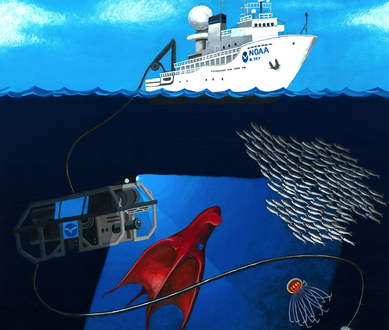
Help from above – using planes, drones, and satellites to study and protect plants and animals **Smithsonian National Air and Space Museum NOAA Family Day**
NOAA Live! All Stars:
Katie Sweeney, NOAA’s Alaska Fisheries Science Center in Seattle, WA
Allison Henry, NOAA’s Northeast Fisheries Science Center in Woods Hole, MA
Brandon Krumwiede, NOAA’s Office for Coastal Management in Duluth, MN
Jennifer Stock, NOAA’s Cordell Bank National Marine Sanctuary in Point Reyes, CA
In partnership with the Smithsonian National Air and Space Museum. This webinar features NOAA experts discussing the ways NOAA aircraft, satellite tracking, and drone technology help us understand marine species and support conservation efforts along our ocean and coasts. How do we use drones to observe northern fur seals, airplanes to identify and count endangered North Atlantic right whales, aerial imagery to manage manoomin (wild rice), and satellite tags to follow seabirds? Learn about the unique tools we use to collect high-quality environmental data to better understand these important species and aid in conservation efforts.
Resources to access at home:
» Soar Together @ Air and Space NOAA Family Day event page: This has links to other live events and fun activities to do with your family
» Arctic UAV’s Game App: Up for a hands-on game challenge? Navigate a flying quadcopter during stormy Alaska weather, catch the perfect aerial shot of rare wildlife, and uncover trails through rough sea ice, all in this mobile app game, Arctic UAVs
» NOAA right whale id matching game- Can you identify the right whales by their callosity? Try it out with these: match the animal cards and answer key
» Seabird and Shorebird Activity Book– The Hawaiian Islands Humpback Whale National Marine Sanctuary put together this fun book. Seabirds secret code, shorebirds word find, seabirds mobile, and more!
» Do a virtual Albatross Bolus dissection– Albatross throw up what they can’t digest. Measure and count natural and non-natural items in this virtual bolus dissection activity.
» Fur seals on Bogoslof Island: Post 4- Evolving Science on an Evolving Island – Katie’s team tested two camera systems on drones on Bogoslof Island in Alaska in September 2019
» New Drone Technology Could Revolutionize Marine Mammal Monitoring
» Association for Unmanned Vehicle Systems International – Student Unmanned Aerial Systems Competition
» Examples of using Unmanned Aerial Systems in NOAA research – NOAA Unmanned Aerial Systems Program
» North Atlantic right whale catalog: The catalog contains all the photographed sightings of right whales from the North Atlantic.
» Stellwagen Bank National Marine Sanctuary Shearwater Tagging Project
» Efforts to Restore Native Wild Rice in the St. Louis River Estuary
» Makani: The albatross that cares for the land: An interactive activity/story book about a Laysan Albatross (pdf download)
» Telepresence technology uses a high-bandwidth satellite connection to allow anyone with an Internet connection to virtually participate in ocean research and exploration expeditions. Join one here and learn more about telepresence here.
Videos
- PBS Wisconsin Education video: This ~4-minute video follows Fred Ackley Jr. from the Sokaogon Chippewa Community of Mole Lake as he harvests and processes manoomin, or wild rice.
- Mapping the Invisible: Introduction to Spectral Remote Sensing: NEON Science video overview of spectral imagery and its use to identify differences between different parts of the electromagnetic spectrum
- Investigating Steller Sea Lion Populations: Join scientists on a research vessel to western Aleutian Islands—closer to Russia than mainland Alaska. Here, they investigate what’s going on with endangered Steller sea lions, some populations of which are declining, while others are thriving
- Henry Wood Elliott: Defender of the Fur Seal: In the twenty years following the United States’ acquisition of the Alaska territory (1867), revenues from the Pribilof Island fur seal harvest paid off the 7.2 million dollar purchase price. This documentary uncovers this little-known piece of American history told through the story of Henry Wood Elliot
- Northern Fur Seal Migrations: Every year, northern fur seals migrate 6,000 miles round-trip from their summer breeding grounds on the Pribilof Islands in the Bering Sea. Learn about the scientists at NOAA who are tracking these seals on their incredible migrations, and where the seals go during the winter
- B-Roll: Northern Fur Seal Research on Bogoslof Island: Select footage of northern fur seal research on Bogoslof Island, an active volcano that erupted from December 2016 – August 2017. This footage was taken August 12-16, 2019, along with some reference match frames that were filmed on July 12, 2005
- NOAA Ocean Today Endangered Ocean: There are several short videos on topics ranging from the endangered species act, manatees, North Atlantic right whales, and more.
- Watch A Perfect Day for an Albatross and Other Seabird Tales, a book reading of Caren Loebel-Fried’s childrens book with special highlights shared from her trip to the Albatross breeding colony on Midway Atoll National Wildlife Refuge and seabird highlights from the Papahanaumokuakea Marine National Monument, a UNESCO World Heritage Site and Cordell Bank National Marine Sanctuary.
- “This is NOAA” video (~3 min): This video describes NOAA’s role as a global leader in environmental science and technology, working to address our Nation’s most pressing challenges and advance our mission of science, service, and stewardship
Previous NOAA Live! Webinars by these experts
- A Bird’s Eye View of Whales with Allison Henry
- Flying Beneath the Clouds at the Edge of the World with Katie Sweeney
- Winged Ambassadors: Ocean Travelers with Jennifer Stock
- Drones, Scat, and the Joys of Marine Mammal Fieldwork in Alaska with Katie Sweeney
- Fresh Coast: Where Food Grows on the Water with Brandon Krumwiede
Carbon’s Journey and Our Warming Planet
Frank Niepold and Tom Di Liberto, NOAA’s Climate Program Office in Silver Spring, MD
The carbon cycle is a process where carbon dioxide travels from the atmosphere into living organisms and the Earth, then back into the atmosphere. Learn how changes in carbon dioxide levels, such as burning fossil fuels (oil, gas, etc.), affect the atmosphere and the ocean. We will flood a “bathroom” and see why it’s a good thing to shut off the water and or make the Earth’s atmosphere “drain” bigger so we don’t mess up our home. This webinar will be recorded and posted here (with English captions and Spanish subtitles) after going live. (Grades 2-6 but all ages will enjoy)
Resources to access at home:
» Why is Carbon Important: This NASA site is aimed at kids and does a nice job of explaining what carbon is as well as its importance.
» The Incredible Carbon Journey: Play the Carbon Journey Game with your class or a group at home (Use the blue “Jump to this Activity” button on the website linked to here).
» MIT’s Greenhouse Gas Simulator: This simple animated simulation of the global carbon system is great for helping kids explore the relationship between carbon emissions and atmospheric carbon dioxide. (Teacher link)
» NASA Climate Kids Offset Game: As you play this online game you earn money so you can buy “upgrades” to your carbon sources and sinks. Meanwhile, carbon dioxide molecules are escaping into the atmosphere.
» Background articles from climate.gov for parents or teachers:
Which emits more carbon dioxide: volcanoes or human activities?
Carbon dioxide: earth’s hottest topic is just warming up
Climate change: atmospheric carbon dioxide
Minutes Matter: Nature’s Warning Signs for Tsunami
Cindi Preller, NOAA’s National Weather Service Pacific Tsunami Warning Center in Honolulu, Hawai’i
May 22, 2020, marks the 60th year since the 1960 Great Chilean earthquake, the largest ever measured at magnitude 9.5, which wreaked havoc across the entire Pacific Basin. Earthquakes and tsunamis have been happening globally since our planet was born. One of the earliest recorded devastating tsunami disasters happened in the Atlantic basin, in 1755, near Lisbon, Portugal. Tsunamis have no season and cannot be predicted. Nature, however, does provide us with clues. It is critical that children learn these life-saving facts since they are the best teachers and will pass these tools onto others. This presentation will provide students with tsunami, earthquake, and volcano education through a variety of games and activities. (Grades 2-6 but all ages will enjoy)
Resources to access at home:
» Tsunami Hazard Maps: States and territories produce maps for their coastlines that identify tsunami inundation and evacuation areas.
» Tsunami Education and Outreach Material: Resources available about tsunami safety, including a 2-minute fast draw animation.
» Pacific Tsunami Warning Center Video Playlist: Collection of videos and animations from the Pacific Tsunami Warning Center
» Tsunami FAQs
» Homeowners Handbook to Prepare for Natural Hazards
» National Ocean Service animation – Know what to do if a tsunami hits—and the risks you face. (~2 minutes long) Shown during the webinar.
» UN video, “Lessons save lives: the story of Tilly Smith”. A clip of this is shown during her webinar.
» University of Alaska Earthquake Center animations. Generation of a tsunami, propagation, etc. (These are used in the webinar)
» NOAA Ocean Today Tsunami Survival Guide Videos: There are 7 short videos- Tsunami awareness, tracking tsunamis, tsunami science, and more.
Stories in the Stone: Archaeology in Papahānaumokuākea Marine National Monument
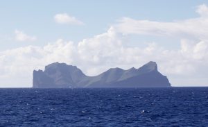
Malia Evans, NOAA’s Papahānaumokuākea Marine National Monument in Hilo, Hawai’i
Take a journey to the most isolated archipelago in the world to learn how ancestral Hawaiians shared ecological and cultural observations and knowledge across time and space. This presentation and hands-on activity will explore the stones of this storied landscape, and the oral traditions and relationships contemporary Hawaiians maintain to Papahānaumokuākea Marine National Monument. Weʻll conclude by designing kiʻi pōhaku (petroglyphs) that represent you, your family, or your community. (Grades 2-6 but all ages will enjoy)
Resources to access at home:
» Native Hawaiian Cultural Heritage in the Monument
» Learn about the special name given to this unique place – You can even listen to an audio file of the pronunciation and practice at home.
» Read about Maliaʻs journey to Papahānaumokuākea in July 2019
» Kids activities and marine archaeology info – Find activity books and a shipwreck gameshow on this website.
» Downloadable Map of Papahānaumokuākea
» Learn more about Polynesian Navigation
» Visit this page for directions on how to submit a photo of your kiʻi pōhaku (petroglyphs) as well as see all the photos we received.
» Videos Malia showed during her webinar: History of Hokulea (~10 minutes), USGS Kilauea Volcano Helicopter Overflight July 21, 2018 (~1 minute), and Nihoa Island (~8 seconds)
» Papahānaumokuākea song and coloring book by Patrick Ching
» NOAA Ocean Today Adventures of a Maritime Archaeologist Videos: There are 7 short videos- What is maritime archaeology, explore with us, sanctuaries, and more.